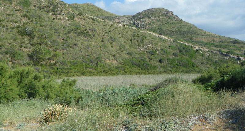
ES533MEN034 - Binimel·là pond
Description

Wetland data
Basic information
| Wetland location: | Marine/Coastal |
| Wetland type: | Natural |
| Wetland area: | 1.7 Ha |
| Hydrological interaction: | - |
| Water salinity: | Brackish (5.0-18.0 g/l) |
| Type of fresh water input: | Catchment area (precipitation) |
| Surface water runoff | There is no obvious water outflow |
| Open water area (%): | < 5 |
| Hydroperiod: | Seasonal |
Geographic information
| Region: | Balearic Islands |
| Island: | Menorca |
| Municipality: | Es Mercadal |
| Longitude: | 4.054771 East |
| Latitude: | 40.051232 North |
Wetland condition
| Wetland status (MEDWET): | 2 - Original habitats/landform still predominant (>50%) |
Ramsar wetland type
| Type | Coverage (%) |
| H — Intertidal marshes | > 95 |
Property status
| Public |
| Protection status category | Protection status subcategory | Area's name | Code | Coverage area (%) | Legislation |
| Other international protection | Biosphere Reserve | Menorca | 100 | ||
| Other international protection | Natura 2000 | Dels Alocs a Fornells (LIC, ZEPA) | ES0000231 | 100 | |
| Other | Urban planning regulations | Dels Alocs a Fornells | ANEI-Me 3 | 100 | Ley 1/1991 |
Important bird areas
| IBA code | Site name | Coverage (%) | References |
| ES325 | North and East Coast of Menorca and Aire Island | 100 | Infante et al., 2011 |
Ecosystem services
| Type of ecosystem service | Ecosystem service | Scale of Βenefit (%) | Importance |
| Supporting services | Nutrient cycling | ||
| Supporting services | Provision of habitat | ||
| Regulatory services | Storm hazard regulation | ||
| Regulatory services | Water purification |
Activities on wetland
| Activity | Intensity |
| 010 = Habitat conservation | High |
Activities on catchment area
| Activity | Intensity |
| 501 = paths tracks cycling tracks | High |
| 620 = Outdoor sports and leisure activities | High |
| 622 = walking horseriding and non-motorised vehicles | High |
Habitat types
| Type | Coverage (%) |
| 92D0 Southern riparian galleries and thickets (Nerio-Tamaricetea and Securinegion tinctoriae) | 26 - 50 |
| 2120 Shifting dunes along the shoreline with Ammophila arenaria (‘white dunes’) | < 5 |
| 1150 * Coastal lagoons | > 95 |
Flora
| Species | Presence status | References |
| Ammophila arenaria (Linnaeus) Link 1827 | ||
| Eryngium maritimum Linnaeus 1753 | ||
| Pancratium maritimum Linnaeus 1753 | ||
| Phragmites australis (Cavanilles) von Trinius ex v | Dominant | |
| Pistacia lentiscus Linnaeus 1753 | ||
| Tamarix sp. |
Fauna
Birds |
Number of individuals |
Nesting |
References |
| Charadrius dubius Scopoli 1786 | Nesting | ||
Amphibians |
Presence status in wetland |
References |
|
| Hyla meridionalis (Boettger, 1874) | Common | Bioatles-CAIB, 2017 |
Bioatles-CAIB, 2017. http://bioatles.caib.es/serproesfront/VisorServlet
Infante, O., Fuente, U. & Atienza, J.C. 2011. Las Áreas Importantes para la Conservación delas Aves en España. SEO/BirdLife. Madrid.
Sitibsa, 2006b. Document tècnic de delimitació, caracterització, classificació i inventari de les zones humides de les Illes Balears. Cartografia Vegetal de les Zones Humides de les Illes Balears. Conselleria de Medi Ambient. Govern de les Illes Balears.
Images