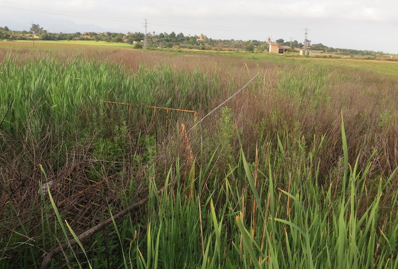
ES532MAL399 - Prat de Son Mascaró meadow
Wetland data
Basic information
| Wetland location: |
Inland |
| Wetland type: |
Natural |
| Wetland area: |
0.3 Ha |
| Hydrological interaction: |
- |
| Water salinity: |
Fresh (< 0.5 g/l) |
| Type of fresh water input: |
Other |
| Surface water runoff |
There is no obvious water outflow |
| Open water area (%): |
5 - 25 |
| Hydroperiod: |
Permanent |
Geographic information
| Region: |
Balearic Islands |
| Island: |
Mallorca |
| Municipality: |
Santa Eugènia |
| Longitude: |
2.840947 East |
| Latitude: |
39.627712 North |
Wetland condition
| Wetland status (MEDWET): |
3 - Original habitats/landform partially modified (10-50% untouched) |
Ramsar wetland type
| Type |
Coverage (%) |
| Tp - Permanent freshwater marshes/pools |
> 95 |
Property status
Ecosystem services
| Type of ecosystem service |
Ecosystem service |
Scale of Βenefit (%) |
Importance |
| Supporting services |
Provision of habitat |
|
|
| Regulatory services |
Water regulation |
|
|
Activities on wetland
Activities on catchment area
| Activity |
Intensity |
| 100 = Cultivation |
High |
| 400 = Urbanised areas human habitation |
High |
| 502 = roads motorways |
Medium |
| 603 = stadium |
High |
Impacts
| Impact |
Intensity |
| EW- = Increase in wilderness/wildlife values |
|
Flora
| Species |
Presence status |
References |
| Rubus ulmifolius Schott 1818 |
Present |
|
| Typha sp. |
Dominant |
|
Fauna
Birds |
Number of individuals |
Nesting |
References |
| Cettia cetti (Temminck 1820) |
|
Nesting |
|