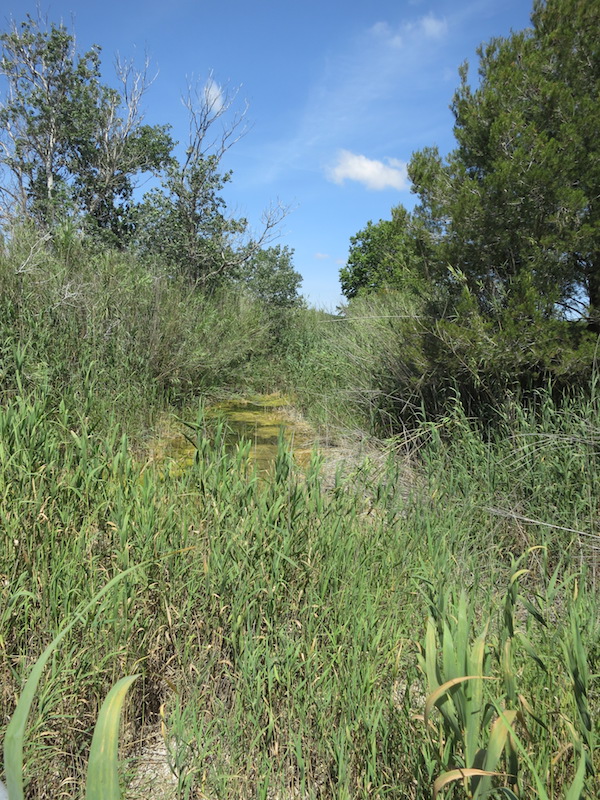
ES532MAL313 - Torrent Son Jordi estuary
Wetland data
Basic information
| Wetland location: |
Marine/Coastal |
| Wetland type: |
Natural |
| Wetland area: |
0.7 Ha |
| Hydrological interaction: |
- |
| Type of fresh water input: |
Torrent / Stream |
| Surface water runoff |
Outflow from lakeshore or river |
| Open water area (%): |
51 - 75 |
| Hydroperiod: |
Seasonal |
Geographic information
| Region: |
Balearic Islands |
| Island: |
Mallorca |
| Municipality: |
Son Servera |
| Longitude: |
3.405723 East |
| Latitude: |
39.637281 North |
Wetland condition
| Wetland status (MEDWET): |
4 - Original habitats/landform highly modified (<10% untouched) |
Ramsar wetland type
| Type |
Coverage (%) |
| F — Estuarine waters; permanent water of estuaries and estuarine systems of deltas. |
> 95 |
Property status
Ecosystem services
| Type of ecosystem service |
Ecosystem service |
Scale of Βenefit (%) |
Importance |
| Regulatory services |
Erosion regulation |
|
|
| Regulatory services |
Flood hazard regulation |
|
|
| Supporting services |
Nutrient cycling |
|
|
| Supporting services |
Provision of habitat |
|
|
| Regulatory services |
Storm hazard regulation |
|
|
| Regulatory services |
Water purification |
|
|
Activities on wetland
| Activity |
Intensity |
| 502 = roads motorways |
High |
| 507 = bridge viaduct |
High |
| 690 = Other leisure and tourism impacts not referred to above |
High |
| 703 = soil pollution |
High |
| 709 = other forms or mixed forms of pollution |
High |
| 803 = infilling of ditches dykes ponds pools marshes or pits |
High |
| 830 = Canalisation |
High |
Activities on catchment area
| Activity |
Intensity |
| 130 = Irrigation |
High |
| 402 = discontinuous urbanisation |
High |
| 502 = roads motorways |
High |
| 601 = golf course |
High |
| 701 = water pollution |
Unknown |
| 800 = Landfill land reclamation and drying out general |
High |
| 830 = Canalisation |
High |
Impacts
| Impact |
Intensity |
| AS- = Loss of scenic value |
High |
| FCD = Loss of faunal diversity |
High |
| HC- = Loss of wildlife corridor(s) |
High |
| HL- = Habitat loss |
High |
| LD- = Decrease in sediment removal/retention |
High |
| LP- = Decrease in prevention of salt intrusion |
High |
| LR- = Decrease in flow regulation |
High |
| LW- = Decrease in wilderness/wildlife values |
High |
| PFO = Fertiliz./Excess nutrient pollut. of an unknown severity/duration |
Unknown |
| SA- = Accretion/Deposition |
Medium |
| VCD = Loss of floral diversity |
High |
| WGT = Lowering of water table |
High |
| WS- = Salt water intrusion |
High |
Habitat types
| Type |
Coverage (%) |
| 92A0 Salix alba and Populus alba galleries |
5 - 25 |
| 92D0 Southern riparian galleries and thickets (Nerio-Tamaricetea and Securinegion tinctoriae) |
5 - 25 |
Flora
| Species |
Presence status |
References |
| Arundo donax Linnaeus 1753 |
|
|
| Phragmites australis (Cavanilles) von Trinius ex v |
|
|
| Populus alba Linnaeus 1753 |
|
|
| Populus nigra Linnaeus 1753 |
|
|
| Rubus ulmifolius Schott 1818 |
|
|
| Tamarix sp. |
|
|
Fauna
Amphibians |
Presence status in wetland |
|
References |
| Pelophylax perezi (Seoane, 1885) |
Very common |
|
|