
ES532MAL118 - Cala de Sa Font Salada estuary
Description
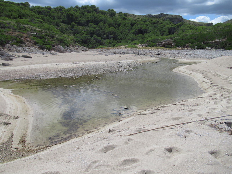
Wetland data
Basic information
| Wetland location: | Marine/Coastal |
| Wetland type: | Natural |
| Wetland area: | 0.5 Ha |
| Hydrological interaction: | - |
| Water salinity: | Brackish (5.0-18.0 g/l) |
| Type of fresh water input: | Torrent / Stream |
| Surface water runoff | Outflow from lakeshore or river |
| Open water area (%): | > 95 |
| Hydroperiod: | Seasonal |
Geographic information
| Region: | Balearic Islands |
| Island: | Mallorca |
| Municipality: | Artà |
| Longitude: | 3.384521 East |
| Latitude: | 39.762772 North |
Wetland condition
| Wetland status (MEDWET): | 1 - Untouched. No signs of man-made changes |
Ramsar wetland type
| Type | Coverage (%) |
| F — Estuarine waters; permanent water of estuaries and estuarine systems of deltas. | > 95 |
Property status
| Maritime-Terrestrial Public Domain |
| Protection status category | Protection status subcategory | Area's name | Code | Coverage area (%) | Legislation |
| Regional protection | Natural Park | Península de Llevant | 100 | ||
| Other international protection | Natura 2000 | Muntanyes d’Artà (LIC, ZEPA) | ES0000227 | 100 | |
| Other | Urban planning regulations | Muntanyes d'Artà | ANEI Ma-10 | 100 | Ley 1/1991 |
Important bird areas
| IBA code | Site name | Coverage (%) | References |
| ES319 | Freu Cape- Farrutx Cape | 100 | Infante et al., 2011 |
Ecosystem services
| Type of ecosystem service | Ecosystem service | Scale of Βenefit (%) | Importance |
| Regulatory services | Erosion regulation | ||
| Regulatory services | Flood hazard regulation | ||
| Supporting services | Nutrient cycling | ||
| Supporting services | Provision of habitat | ||
| Regulatory services | Storm hazard regulation | ||
| Regulatory services | Water purification |
Activities on wetland
| Activity | Intensity |
Activities on catchment area
| Activity | Intensity |
| 010 = Habitat conservation | High |
Habitat types
| Type | Coverage (%) |
| 1150 * Coastal lagoons | > 95 |
Infante, O., Fuente, U. & Atienza, J.C. 2011. Las Áreas Importantes para la Conservación delas Aves en España. SEO/BirdLife. Madrid.